This site uses cookies for better user experience and analytics.
Veloce Club Calais - Luxembourg Grand Loop GPX routes
£5.00
An epic cross-border journey linking the windswept Côte d’Opale with the rolling heart of the Ardennes, the Calais–Luxembourg Grand Loop is a four-day motorcycle tour designed for those who crave distance, flow and beautifully quiet European roads.
Covering approximately 673 miles over four days, this route unfolds with natural progression — from the exposed coastal plains of northern France to the wooded ridge lines of southern Belgium and Luxembourg, before sweeping back towards the Channel.
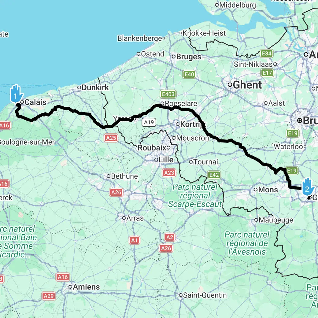
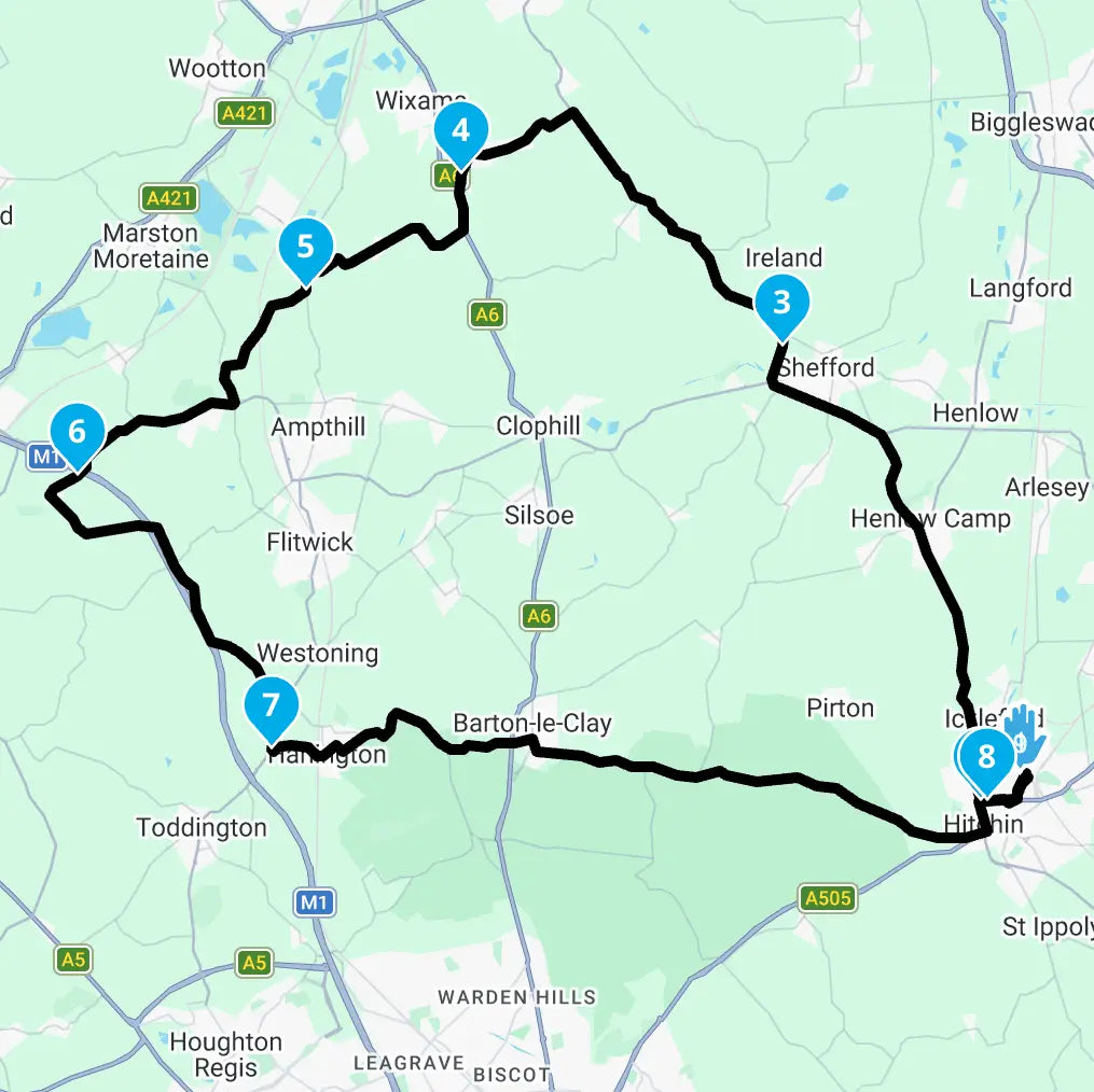
Day 1 – Calais to Charleroi (162 miles)
Departing from the historic port of Calais, the tour begins with fast, open roads and expansive skies. Northern France delivers broad agricultural plains, long sightlines and smooth tarmac — perfect for settling into the journey.
Crossing into Belgium, the landscape begins to rise and fold gently, marking the transition from coastal flatlands to a more undulating interior. It’s a strong opening stage that balances momentum with anticipation of what lies ahead.
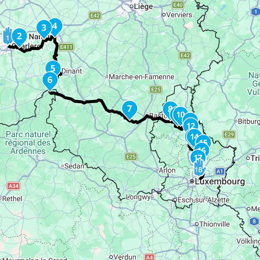
Day 2 – Charleroi to Luxembourg (165 miles)
Heading southeast, the scenery becomes greener and more sculpted as the route approaches Luxembourg. Traffic thins, road quality improves and the character shifts towards sweeping bends and rolling elevation.
The influence of the Ardennes is unmistakable — wooded valleys, river-cut landscapes and flowing stretches that reward smooth, confident riding. Arrival into Luxembourg brings a distinct cultural shift, with immaculate roads and a capital that feels both compact and cosmopolitan.
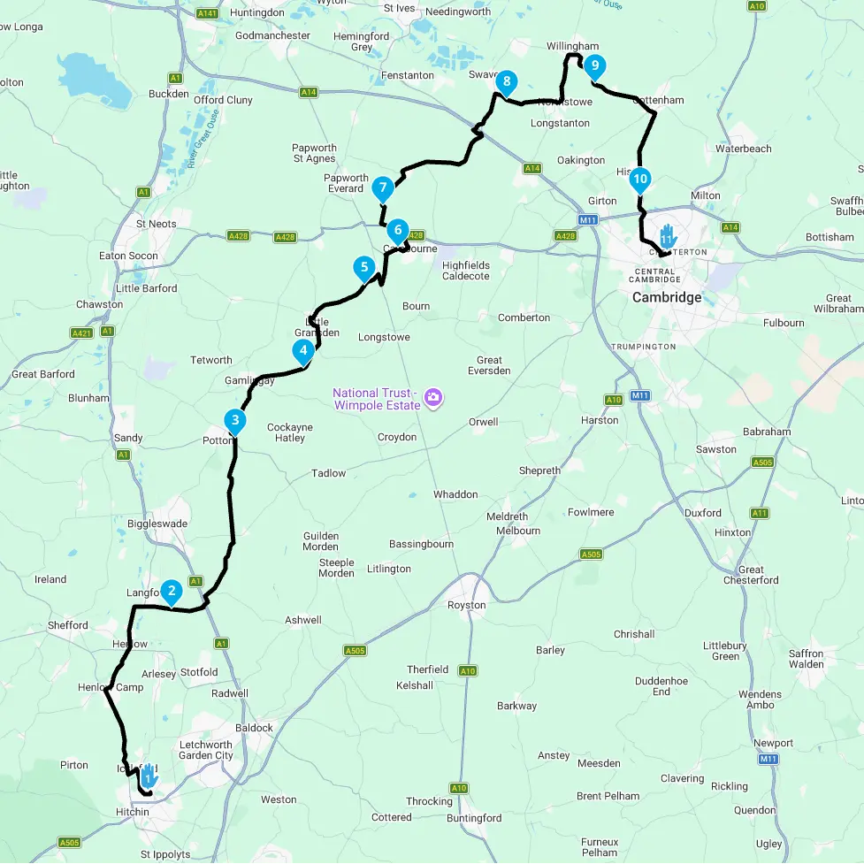
Day 3 – Luxembourg to Charleroi (183 miles)
The longest and most engaging stage of the tour. At nearly 183 miles, this section fully embraces the rhythm of the Ardennes.
Expect continuous undulation, sweeping curves through forested hills and long, flowing descents that make the most of the terrain. The roads here feel purpose-built for two wheels — technical enough to remain engaging, yet open enough to maintain an effortless flow.
This is the day where the landscape and the machine feel perfectly aligned.
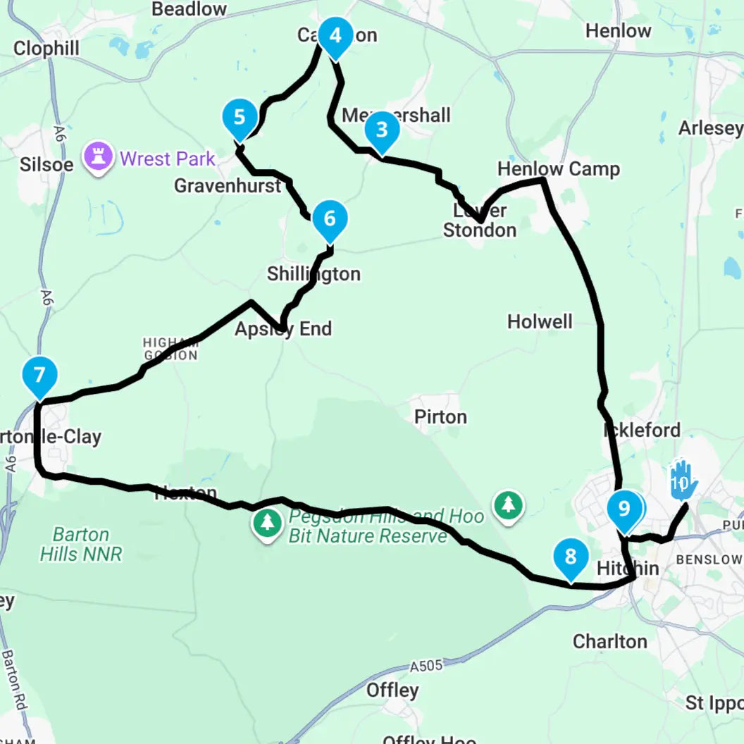
Day 4 – Charleroi to Calais (162 miles)
The final stage trends back towards open farmland and wider horizons. Gradually, the terrain softens and the roads straighten, allowing for a relaxed yet satisfying run back towards northern France.
As Calais approaches, the sense of completion builds — coast to highland and back again, across borders and through some of Europe’s most understated scenery.
Route
The route is broken down 4 separate gpx files for each day.
Total Distance: ~673 miles
Daily Range: 162–183 miles
Terrain: Coastal plains, rolling farmland, Ardennes hills
This is not an extreme alpine expedition. Instead, it is a grand-touring experience — varied, progressive and rewarding. Elevation builds gradually, with the most sustained undulation centred around Luxembourg and the Ardennes.
Why ride it?
The Calais - Luxembourg Loop is about scale, atmosphere and rhythm. Three countries. Expansive horizons, dense forests, quiet border crossings and the satisfaction of completing a true international loop under your own power.
For riders seeking a refined European touring experience without extreme mountain passes, this route delivers distance, variety and understated beauty — in classic Veloce Club style.
Motorcyclists can download these 4 GPX files for easy use with Beeline Moto II or INNOVV N2 or other motorcycle GPS navigation device and ensuring accurate navigation and ride tracking.
Pairs well with
Digital download - you will receive an email
Money goes to charity!
Veloce Club Calais - Luxembourg Grand Loop GPX routes
We offer a variety of route lengths, from half-day rides to multi-day touring adventures. Each route description includes distance and estimated duration.
Do I need an internet connection to use the routes?
No. Once downloaded and imported into your GPS device or app, you can use the route offline.
Can I use these routes on my smartphone?
Yes. You can import the GPX files into many motorcycle-friendly apps on iPhone or Android.
Which GPS devices are your routes compatible with?
Our GPX routes work with most major devices and apps, including Beeline Moto II, INNOVV N2 and other physical devices as well popular mobile navigation apps.
Who are these routes designed for?
Our routes are designed specifically for motorcyclists, prioritising scenic roads, enjoyable riding sections, and great stops along the way.
Why do you charge for routes?
We charge a nominal fee - not for us, but we use the money collated (along with other events and activities) to make a donation to a designated charity at the end of the year.
The routes do involve planning then riding the route and then updating - and that does take up time. In addition the software used does come with an annual fee. So whilst we don't charge to make money, we felt (and we also ran this past people in our community) that a small fee that goes to charity would be a great idea.
Its a win-win - you get a great route and a charity gets some money!
How do I use a GPX file?
A GPX file (GPS Exchange Format) is a universal, XML-based text file used to store and share GPS data, including waypoints, routes and tracks for navigation. Whilst no two platforms are the same, the general rule of thumb is to import you .gpx file and should be opened by your platform/device.
Where is my route download?
After purchasing your GPX route, you will receive an email which will contain a link to the download. If you haven't received your email, please check your junk/spam folder. If you still don't have it, then drop an email with your order number to hello@veloceclub.co.uk and we'll send it over
Are your routes genuine?
Yes! All of our routes we have ridden once, twice or more! These routes have been planned, mapped and ridden by a team member at Veloce Club before we publish it. So there is no AI crap here... all human made!
Why do you publish routes?
Veloce Club is a motorcycle destination - we're trying to make it into a community hub. And as such we lead lots of ride outs or have groups come to the shop and ask about routes. So we thought lets get a route library together!
What is included when I purchase a route?
Each purchase includes a high-quality GPX file containing the full route, carefully planned roads, waypoints, and highlights. You’ll also receive basic instructions on how to use the file on your device or app.
Choosing a selection results in a full page refresh.